 Print This Page
|
Print This Page |
What's New for 2007
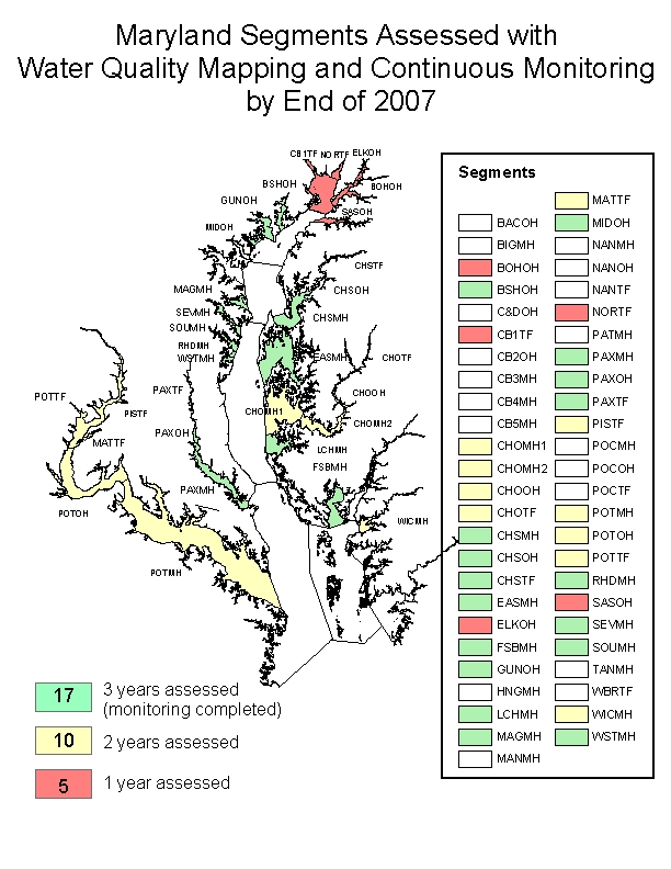
In 2006, DNR completed the monitoring for 3-year criteria assessments of Chester River, Eastern Bay, South River and West/Rhode Rivers. Instrumentation and other resources from these systems can now be moved to other systems. Starting in 2007, shallow water assessments (Continuous Monitoring and Water Quality Mapping) will begin in Elk River, Northeast River, Bohemia River and the Susquehanna Flats area of the Chesapeake Bay. In addition, Water Quality Mapping will now be conducted on the Sassafras River. Shallow water monitoring is partially completed and will continue for the Wicomico, Choptank, Little Choptank, and Potomac Rivers. (See Map.)
Continuous Monitoring stations at South River – Harness Creek will remain active thanks to partnerships with South River Federation, Chesapeake Bay Foundation, Chesapeake Bay Trust, NOAA, National Fish and Wildlife Foundation, and the Oyster Recovery Partnership. Similarly, Continuous Monitoring stations at Eastern Bay – Chesapeake Bay Environmental Center (CBEC) and Rhode River – Smithsonian Environmental Research Center (SERC) will remain active due to partnerships with CBEC and SERC, respectively.
Water quality data, Maryland DNR website: www.eyesonthebay.net .