 Print This Page
|
Print This Page |
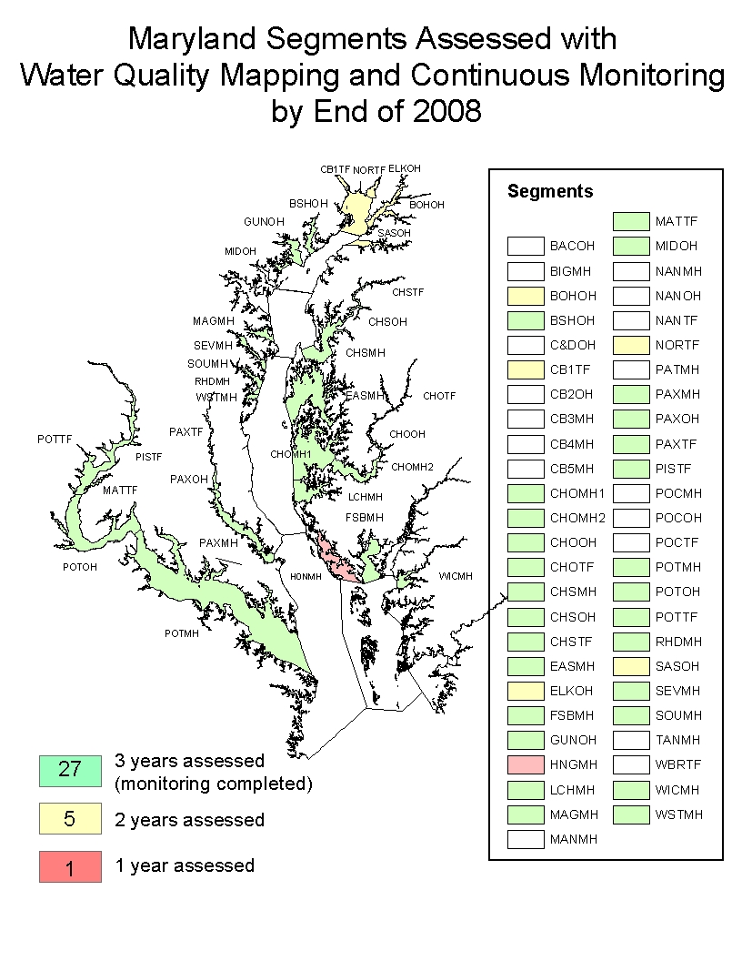
What's New for Continuous Monitoring and Water Quality Mapping in 2008
In 2007, DNR completed the monitoring for the 3-year criteria assessment of the Little Choptank River. The Continuous Monitoring and Water Quality Mapping instrumentation and other resources for the Little Choptank are being relocated to the Honga River to begin the 3-year assessment of that system. Also, the Bush River Continuous Monitoring site at Lauderick Creek has been relocated upriver to Church Point, and the Coastal Bays – Turville Creek site has been relocated north to Grey's Creek. The other stations sampled in 2007 will continue with the exception of the following which have been discontinued; the Patuxent site at Pin Oak Farm and the Chesapeake Bay site at Sandy Point East. Shallow water monitoring for the 3-year criteria assessments are partially completed and will continue for the Wicomico, Choptank, Elk River, Bohemia River, Sasafras, and Potomac Rivers (See Map).
Continuous Monitoring stations at South River – Harness Creek will remain active thanks to partnerships with South River Federation, Chesapeake Bay Foundation, Chesapeake Bay Trust, NOAA, National Fish and Wildlife Foundation, and the Oyster Recovery Partnership. Similarly, Continuous Monitoring stations at Eastern Bay – Chesapeake Bay Environmental Center (CBEC) and Rhode River – Smithsonian Environmental Research Center (SERC) will remain active due to partnerships with CBEC and SERC respectively. The four National Estuarine Research Reserve (NERR) sites will also continue in 2008. These include the three stations on the upper tidal Patuxent River – Jug Bay, Iron Pot Landing, Mataponi, and the Bush River station at Otter Point Creek.
Water quality data, Maryland DNR website: www.eyesonthebay.net .