Print This Page
|
Print This Page |
Mapping Areas That Are Conducive to Bay Grass
Growth
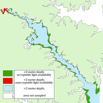
Water
quality mapping data can be used to delineate areas in rivers that are conducive
to bay grass growth. Turbidity data, which is a measure of water clarity, can
be used to calculate the depth through which sunlight can penetrate the water
column. Coupled with bathymetry data, the sunlight penetration data can be averaged
during the initial bay grass growing period to estimate areas that will have
adequate light to support bay grass growth. Green and red areas represent depths
of less than two meters, where green indicates adequate light was available
during April and May, and red areas represent a deficiency of light penetrating
the water. Much of the Severn River experienced low turbidities and good water
clarity in 2002, due to the drought and subsequent lower sediment and nutrient runoffs.