Print This Page
|
Print This Page |
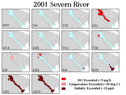
Tracking Areas of Habitat Limitation for Yellow
Perch
Water
quality mapping data can be used to delineate areas in rivers that experience
habitat conditions detrimental to living resources. In this example, areas of
habitat limitations for adult yellow perch (low dissolved oxygen, high water
temperature and high salinity) were mapped. The maps illustrate that on May
31, 2001, much of the river has stressful oxygen levels and later in the year
a drought dramatically increases salinities, causing a possible constriction
in yellow perch habitat.