|
May 21, 2003
Mahogany Tide widely observed south of the Bay Bridge by fishermen and boaters this week. |
|
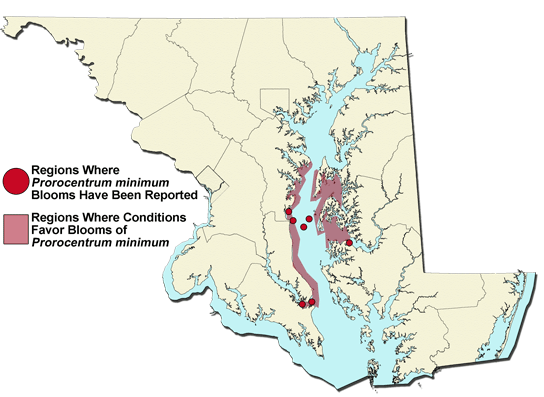
World wide web reports by the Bay public have provided a broader picture of the distribution of what is largely Mahogany Tide blooming around the Bay this week, caused by the dinoflagellate algal species known as Prorocentrum minimum. The observations support the findings of the Chesapeake Bay Monitoring Program sampling in recent weeks. Reports of reddish-brown waters from Annapolis tributaries south to the Lower Patuxent region on the western shore of the Bay and Kent Island south into the Choptank River on the Eastern Shore have been common this week. Concentrations of Mahogany Tide have been lower in the Main Bay than in the tributaries but some reports, including discussions with Captain Jim Brincefield fishing out of Deale, MD, have indicated dark patches of blooms are dispersed in offshore areas. Captain Brincefield provided a water sample from a dark offshore patch of bloom water near Black Walnut Point on May 19th that had significant concentrations (63,135 cells/ml) that were above some recent measurements of bloom conditions in tributary regions.
Bloom conditions caused by Prorocentrum minimum are likely to persist in the lower tributaries and the Main Bay over the next couple of weeks before declining as summer season conditions arrive in our region. Typically, this bloom gradually moves north of the Bay Bridge and by the first week of June may appear in the Baltimore region on the western shore. South of the Bay Bridge in late spring and summer Prorocentrum minimum is usually replaced by other dominant algal species that favor the calmer, warmer conditions we receive on the Bay. To learn more about
how the Bay monitoring data shows changes in important water quality parameters,
please visit the Monitoring Stories
and Highlights section of Eyes on the Bay. |