SONDE CALIBRATION and POST-CALIBRATION
The Yellow Springs Instrument (YSI) 6600 V2 and EXO2 data sondes were maintained and calibrated before and after each deployment in accordance with YSI recommendations. <
https://www.ysi.com/customer-support>
FIELD MEASUREMENTS AND SAMPLING
SONDES:
The continuous monitoring sensors at the sites recorded seven water quality parameters every 15 minutes. Data were uploaded to DNR's web site <
http://www.eyesonthebay.net> shortly after retrieval.
At all sites the seven water quality parameters measured continuously were: water temperature, specific conductance (used to derive salinity values), dissolved oxygen, oxygen percent saturation, turbidity (NTU/FNU), fluorescence (used to estimate chlorophyll a), and pH. Sondes deployed at fixed depths also measured water depth.
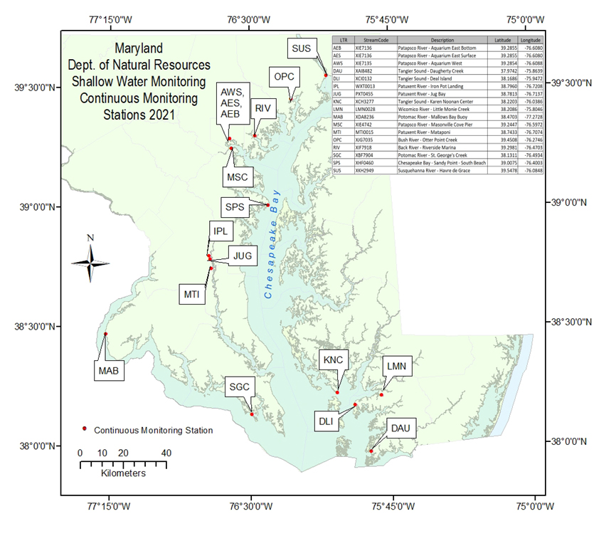
Five monitoring stations were equipped with a YSI 6600 V2 sonde. These stations were: WXT0013 (Iron Pot Landing), XIE4742 (Masonville Cove Pier), MTI0015 (Mataponi), XKH2949 (Havre de Grace), and XHF0460 (Sandy Point - South Beach). The following eleven stations were equipped with a YSI EXO2 sonde: LMN0028 (Little Monie Creek), XIE7135 (Aquarium West), XIE7136 (Aquarium East Surface and Bottom), XIF7918 (Riverside), XBF7904 (St. Georges Creek), XCH3277 (Karen Noonan Center), XCI0132 (Deal Island), XAI8482 (Daugherty Creek), XDA8236 (Mallows Bay Buoy), PXT0455 (Jug Bay), and XJG7035 (Otter Point Creek). Both types of sonde logged data onto an internal memory, where it was stored until retrieval. Eight stations were equipped with cellular telemetry units, which allowed data to be transmitted hourly to a server computer at DNR. Most sondes were deployed inside vertically-oriented PVC pipes with several two-inch holes drilled along their length to allow for water exchange. Depending on location, these sondes were either suspended from a float 1.0 meters below surface or fixed 0.3 meters or 0.5 meters above bottom resting on a stop bolt. Some EXO2 sondes were deployed inside a crabpot-like structure that rested on the bottom and suspended the instrument 0.3 meters off bottom in a horizontal PVC tube tethered to a pier with a cable.
Sondes at the following stations were deployed at a fixed depth of 0.3 meters above the bottom: LMN0028 (Little Monie Creek), MTI0015 (Mataponi), PXT0455 (Jug Bay), WXT0013 (Iron Pot Landing), XJG7035 (Otter Point Creek), XKH2949 (Havre de Grace), XIE7136 (Aquarium East - Bottom), XCH3277 (Karen Noonan Center), XCI0132 (Deal Island), and XAI8482 (Daugherty Creek).
Sondes at station XBF7904 (St Georges Creek) were deployed at a fixed depth of 0.5 meters above the bottom.
Sondes at stations XIE7135 (Aquarium West), XIE7136 (Aquarium East Surface), XIF7918 (Riverside), XHF0460 (Sandy Point - South Beach), XIE4742 (Masonville Cove Pier) and XDA8236 (Mallows Bay Buoy) were deployed suspended from buoys or floats at a depth of 1.0 meter below the surface.
Note that sondes were deployed concurrently at two depths at station: XIE7136.
WATER QUALITY CALIBRATION SAMPLES:
Every time sondes were exchanged at each Continuous Monitoring station, "grab" water quality samples were collected at 1.0 meter depth, or at deployment depth for stations deployed at a fixed depth above the bottom, using a horizontal "Alpha" water sampler. At the time the water was collected, a Hydrolab or EXO sonde measurement was taken at 1.0 meter or at deployment depth. Note that no samples were collected by DNR at stations XIE7135 and XIE7136.
Numbered two-quart bottles were triple-rinsed and filled with water for "whole" and "filtered" nutrient and chlorophyll samples. (As noted previously, full suites of nutrient samples were not collected at all stations).
Nutrient, pigment and suspended-solid water samples were filtered on station or shortly thereafter. Sample waters and filters were placed on ice immediately after filtration.
Particulate samples included: Chlorophyll, Pheophytin, Particulate Carbon, Particulate Nitrogen (PN), Particulate Phosphorus (PP), Total Suspended Solids (TSS) and Volatile Suspended Solids (VSS).
Filtrate collected from TSS/VSS or PP/PIP filtrations was used for dissolved nutrient samples. Total Dissolved Nitrogen (TDN) and Total Dissolved Phosphorus (TDP), Nitrite plus Nitrate, Ammonium, and Orthophosphate.
HYDROLAB/EXO PROFILE:
The first reading of the Hydrolab or EXO water column profile at each station was recorded at the same time the water quality "grab" sample was collected. After the 1.0 meter depth record was logged, the sonde was lowered to the bottom. A reading was taken at 0.3 meters above the bottom. The sonde was raised and measurements were recorded at 0.5 meter or 1.0 meter increments until it reached the surface. (In cases where station depth was greater than 3 meters, the sonde was raised in 1 meter increments).
SECCHI DEPTH:
Secchi disk depth was measured each time sondes were exchanged. Readings with the Secchi disk were made in-situ without the aid of sunglasses. The Secchi disk was lowered into the water, on the shady side of the boat or pier. The depth at which the disk was no longer visible was recorded. The time at which the reading was taken was noted. This facilitated later matching of Secchi depth readings with transmissometer and turbidity data.
PAR MEASUREMENT:
Underwater Photosynthetically Active Radiation (PAR, 400-700nm)
When meters were exchanged at a site, down-welling light penetrating the water column (PAR) was measured underwater at several depths to calculate the light attenuation coefficient, Kd. Simultaneous surface and submersed PAR intensity measurements were taken to account for variability in incident surface irradiance due to changes in cloud cover. Data collected from this procedure were used to estimate the depth of the photic zone.
The equipment used was manufactured by LI-COR, Inc. and consisted of a LI-192SA, flat cosine Underwater Quantum Sensor, a LI-190SA air (deck) reference sensor and a Data Logger (LI-1000 or LI-1400).
Surface and underwater readings were recorded simultaneously. Readings were allowed to stabilize before being recorded. If the station depth was less than 3 meters, readings were taken at 0.1 meter and then at 0.25 meter intervals, until 10% of the 0.1 meter reading was reached. If the station depth was greater than 3 meters, a reading was taken at 0.1 meter and at 0.5 meter intervals until 10% of the 0.1 meter reading was reached.
PAR readings had also been collected at 15-minute intervals during deployment dates at station XBM8828 (Public Landing) between 2005 and 2012. All 2013 readings were considered invalid, however, due to equipment failure and the PAR sensor has not been deployed since 2013.
SONDE DATA CHECKS
At stations that utilized 6600 V2 data loggers, the continuous monitoring sondes were retrieved, calibrated and replaced bi-weekly during deployment. At eleven stations, data loggers equipped with more advanced monitoring technology that allows for longer deployments were exchanged every two to four weeks. Data loggers deployed from November to March were exchanged monthly because less biofouling, which may compromise data integrity, occurs during cold weather months. At each deployment, sondes were replaced with clean, recalibrated units and data from the data loggers were downloaded to a computer.
In the field, before an instrument was replaced, field staff allowed both the new (freshly calibrated) sonde and the old (deployed) sonde to log two readings (fifteen minutes apart at most stations) side by side at the same depth. At all of the stations, for one of the simultaneous readings, data were recorded from a discrete instrument (a Hydrolab or EXO sonde). This three-way comparison assured that the "new" and "old" sondes were both reading each parameter within a certain tolerance. The Hydrolab or EXO reading was used as a "double-check," and since it was a discrete reading, it allowed staff to watch the display and note whether the parameters were fluctuating or stable.
EcoWatch(TM) software (a YSI product) was used to calibrate the YSI 6600 V2 instruments, as well as to upload and view data collected. KOR(TM) software (a YSI product) was used to calibrate the EXO2 instruments, as well as to upload and view data collected. Data downloaded from the sonde were subjected to quality assurance/quality control checks to ensure that values outside the range of possibility were not displayed on the DNR web site <
http://www.eyesonthebay.net>.
Data were evaluated using both three-way in-situ comparison results and data from sonde calibrations. The comparison tolerances were as follows for both pre- and post-calibration and in-situ comparisons: Temperature (deg C) +- 0.2; Specific Conductance (uM/cm) +- 5%; Dissolved Oxygen (mg/l) +- 0.5 mg/l; pH +- 0.2; Turbidity (NTU/FNU) +- 5% or 5.0 NTU/FNU (whichever is greater); Chlorophyll (ug/l) +- 5% or 5.0 ug/l (whichever is greater).
Excessive drift between pre- and post- calibration values of sonde probes, variance from in-situ measurements or probe failures caused data to be flagged. When post-calibration drift exceeded the limits stated above in both the post-calibration and the in-situ comparables, suspect data were masked within the data set with an error code (see Quality Assurance Project Plan for list of error codes).
SONDE FILE POST-PROCESSING:
Each "raw" .csv file of sonde data was post-processed using an Excel(TM) macro. The file was opened and renamed. Rows of data acquired before and after deployment were deleted. Records (if any) were also deleted if instrument error codes indicated erroneous data. The macro rearranged columns and inserted error-tracking columns and headings. Macro statements flagged negative values, missing values and highlighted values outside each parameter's normal range. The macro also returned a report summarizing range exceedances. Event and instrument information was appended to each record.
Flagged values were evaluated. Common anomalies included spikes in fluorescence and turbidity, dips in specific conductance, and extremely high dissolved oxygen readings. Instrument post-calibration results, in-situ comparisons with Hydrolab, LI-COR readings, historical data from nearby locations, and survey crew remarks were used to determine whether sensor values were acceptable.
In cases where data were determined to be unreliable, the reason(s) were documented with error codes and comments. Unreliable data were masked. No data were discarded. Only data considered reliable were published in reports.
Field biologists and data analysts reviewed continuous monitoring data weekly. If a problem was identified, a field team member was dispatched to replace the instrument as soon as possible.
VERIFICATION AND DATA MANAGEMENT
At the end of the monitoring season, DNR data analysts and field biologists conducted additional data QA/QC procedures. All of the data were plotted and outliers and anomalous values were thoroughly researched. Staff compared unusual values to historic values from the site and values from nearby sites in the Bay. Weather events were considered, event logs were reviewed, and field staff members were consulted regarding possible legitimate causes for the values. In cases where values were not considered legitimate, error codes were assigned. All data were retained in the archive data set. After field staff and the Quality Assurance Officer reviewed error flags, the values were masked within the published dataset.