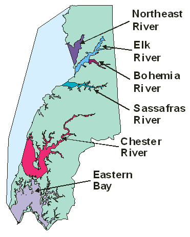
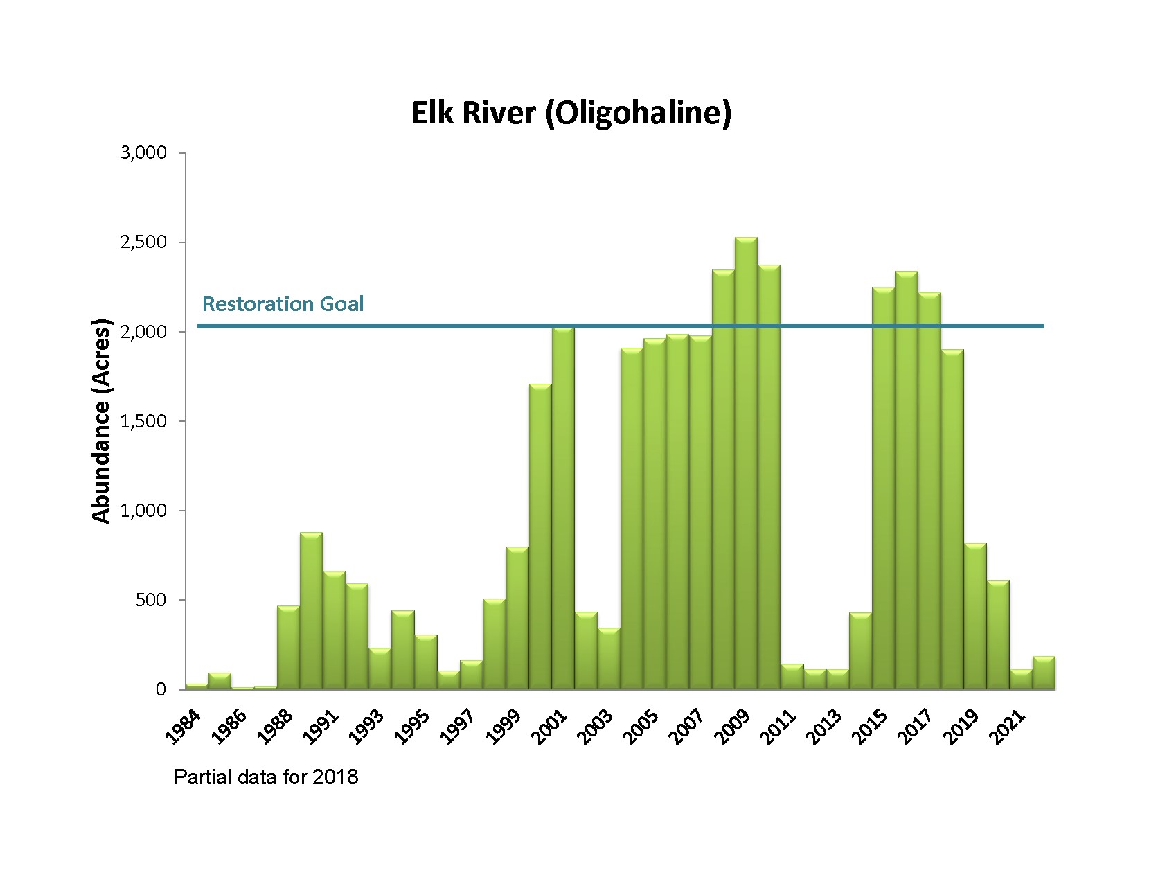
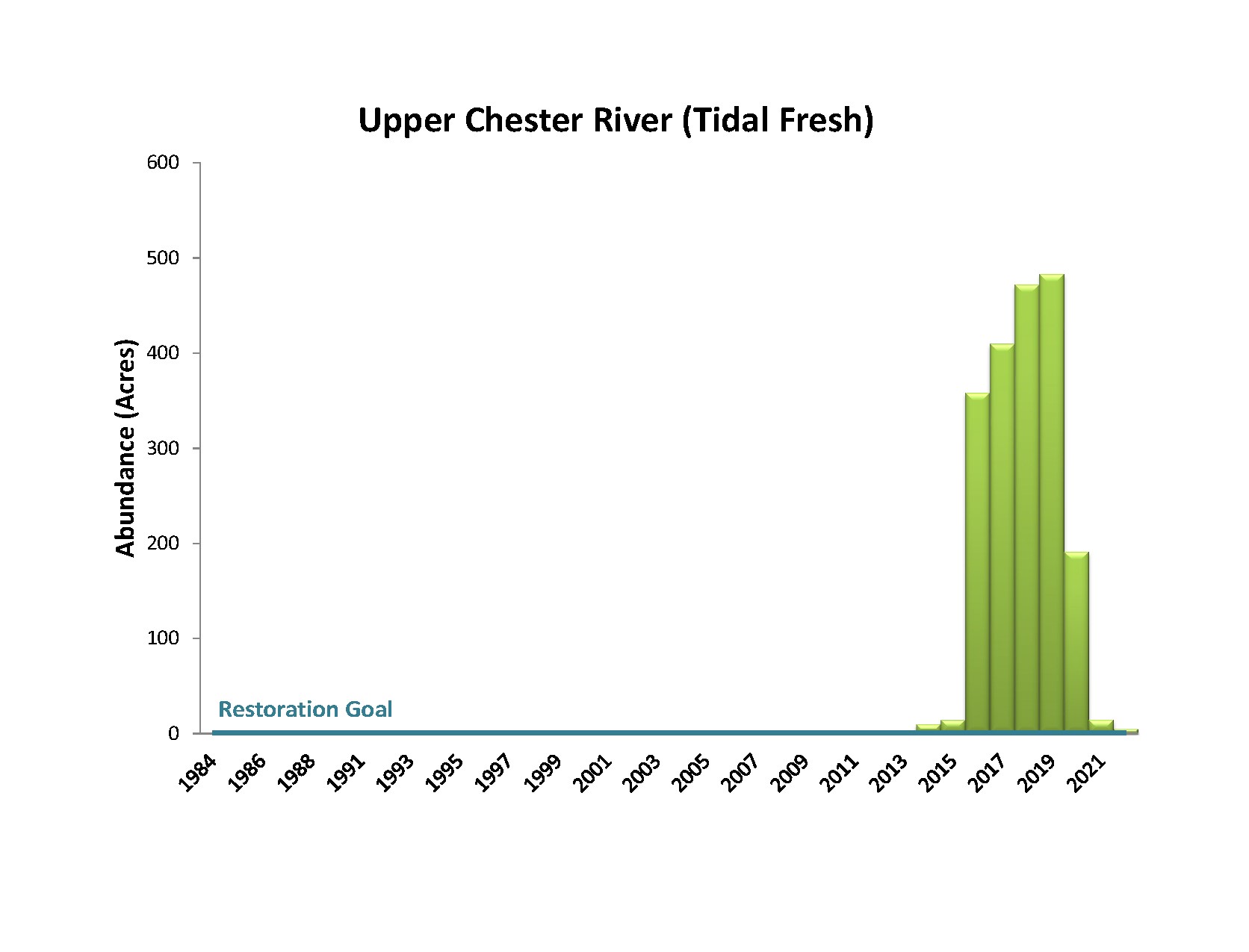
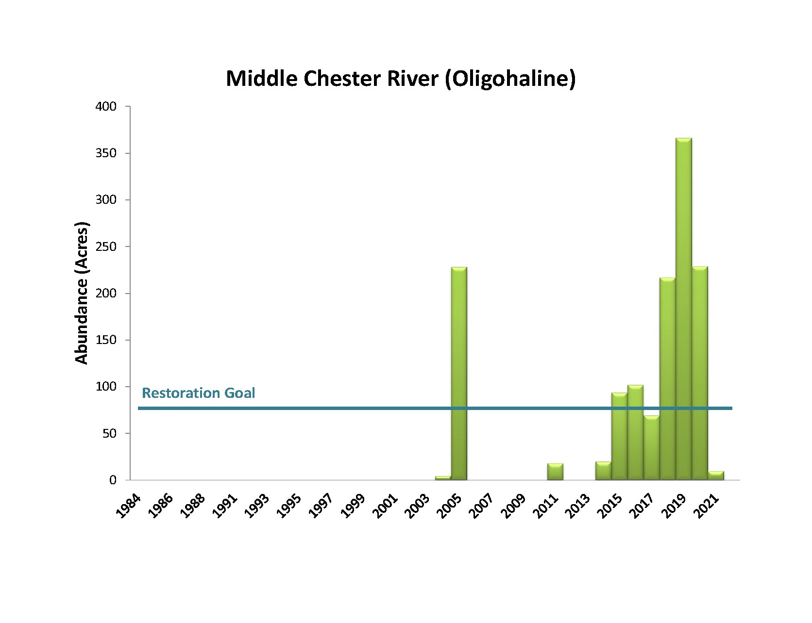
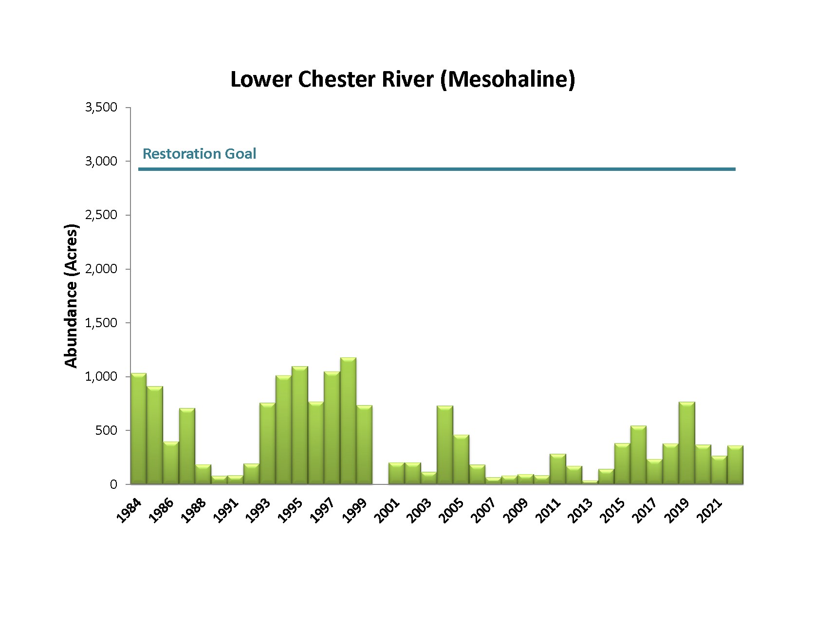
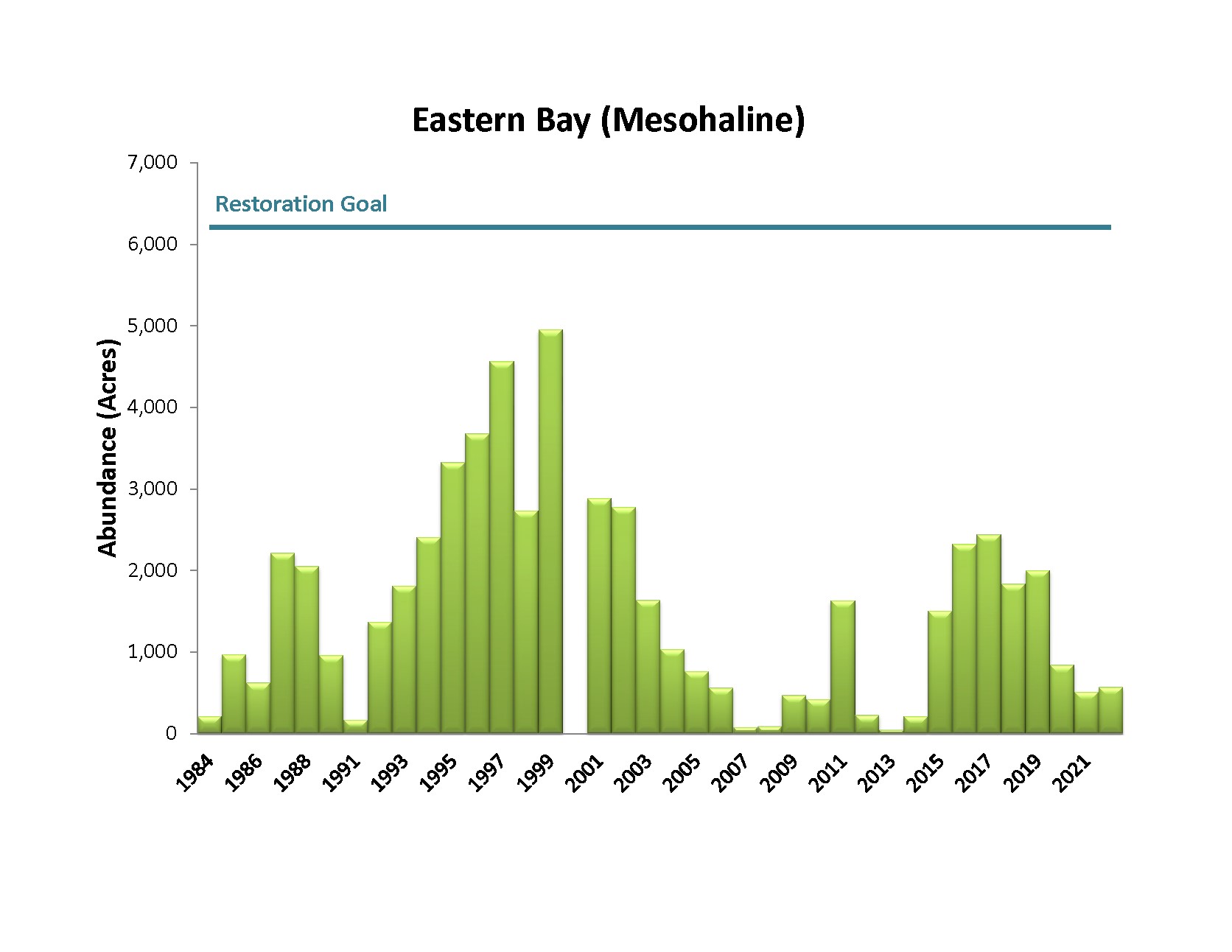
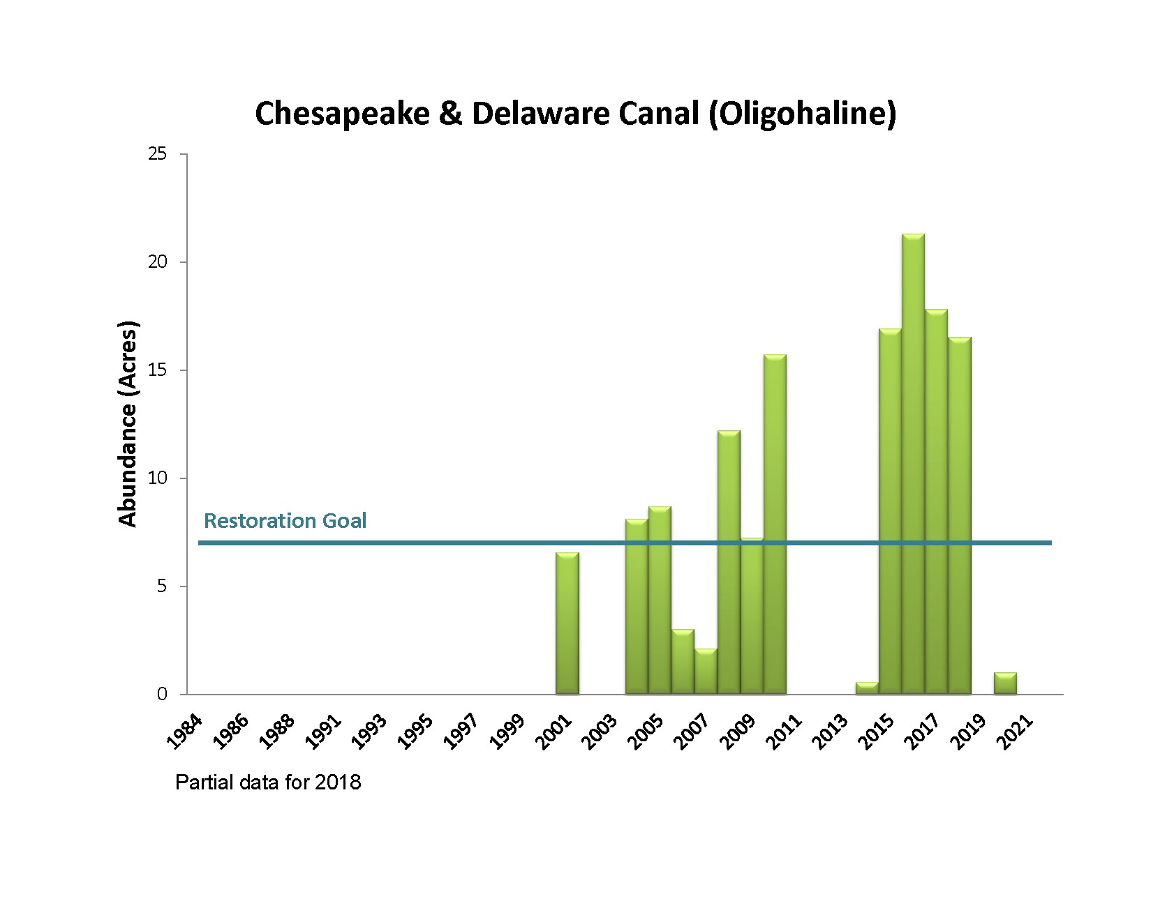
Upper Eastern Shore Bay Grass Distribution

Choose a river from the menu to view bay grass acreage data:

Upper Eastern Shore Map of Tributaries

Accessibility Notice: We are currently working to remediate all SAV PDFs to be fully accessible. If you have an immediate need for an accessible version of a document, please contact us at brooke.landry@maryland.gov.

Bar chart showing Northeast River Bay Grass Acreage
Bar chart showing Elk River Oligohaline Bay Grass Acreage
Bar chart showing Bohemia River Oligohaline Bay Grass Acreage
Bar chart showing Sassafras River Bay Grass Acreage
Bar chart showing Upper Chester River Tidal Fresh Bay Grass Acreage
Bar chart showing Middle Chester River Oligohaline Bay Grass Acreage
Bar chart showing Lower Chester River Mesohaline Bay Grass Acreage
Bar chart showing Eastern Bay Mesohaline Bay Grass Acreage
Bar chart showing Chesapeake & Delaware Canal Oligohaline Bay Grass Acreage

Contact the Maryland Department of Natural Resources, Tidewater Ecosystem Assessment's Brooke Landry at (410) 260-8629 or brooke.landry@maryland.gov

>> Back to Bay Grass Home <<