Skip to Main Content

Eyes on the Bay Home

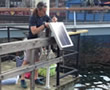
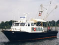
Thank you for visiting Eyes on the Bay, your home for Maryland tidal water quality data and information. We hope that our data search and download pages will be useful tools. The map below displays all the stations where we collect water quality data, as well as partner stations.

  • Filter Stations: check/uncheck the boxes for each water quality data type to turn data points on/off
  • Change Year: use this dropdown to view what stations were sampled in different years
  • Show Legend: mouseover this menu to display the legend for the station markers
  • Station markers: click to view station details, and link to data and charts
  • Zoom/Pan: zoom in & out using your mouse scroll button; click & drag to move the map around (mobile: pinch to zoom, touch & drag to move map)

For full-screen map view click here
For full functionality we suggest using Google Chrome or Mozilla Firefox.
Show Legend
Station Legend
Long-Term Fixed Station
Dataflow / Water Quality Mapping Segment
Continuous Monitoring Station with Real-time Telemetry
Continuous Monitoring Station without Telemetry
purple dot Vertical Profiler Continuous Monitoring Station
Continuous Monitoring Station not Currently Active
Partner Sites
National Data Buoy Center or NOAA buoys
Tide Prediction Sites
(Click for current weather/water conditions)
More info on:
"Our Monitoring Explained"
Change Year
Select Another Year
for Map Display:
Filter Stations

Please wait while the map loads...


       Eyes on the Bay Water Quality Data:

Installation of a continuous monitoring sonde at National Aquarium in Baltimore

Continuous Monitoring

Water quality data measured every 15 minutes at sites around Maryland since 2001.
Spatial Water Quality Data Map

Surface Mapping

High frequency spatial data collected monthly in Maryland bays and rivers.
Research vessel Kerhin

Long-term Monitoring

Tidal and non-tidal data collected monthly since 1985 throughout Maryland.
R/V Kerhin leaving Solomons


       Eyes on the Bay 'Data Bytes':

January 25, 2021

 Where's the Data?

2020 was obviously a challenging year. Our biologists, who have been out in field with the exception of March-April 2020, have followed strict guidelines while sampling during the pandemic. Our formal data submissions to the Chesapeake Bay Program have been delayed, in most part because our data entry provider was shutdown until late December 2020. Now that we're slowly receiving those laboratory and field data back, they will undergo a rigorous Quality Assurance process, prior to final submission and availability. 

For data status updates by month and monitoring program, please visit our status page at:

http://eyesonthebay.dnr.maryland.gov/eyesonthebay/DataStatus.cfm


December 15, 2020

Our Mallows Bay buoy was recently removed for the winter. 
We will redeploy in the Spring of 2021. 

Thanks to the National Marine Sanctuary Foundation 
for funding the purchase of the buoy. 
https://marinesanctuary.org/sanctuary/mallows-bay-potomac-river/


August 12, 2020

Late July Chesapeake Bay Hypoxia Report Available:


August 3, 2020

Due to approaching storm Isaias 
our continuous monitoring stations at
Public Landing-Coastal Bays; Hooper's Island, 
Seashore Beach and Point Lookout
have been temporarily removed to protect our equipment.

We will reinstall these sites as soon as the hazards have passed.


   View Data Bytes Archive >>