
Click Before You Cast:
Using online fishing resources to catch more fish
"Where are the fish?" It is an age-old question Chesapeake Bay anglers ask when searching countless tidal creeks, rivers and bays stretching over 4,500 square miles and averaging 21 feet deep. We all understand that fish are influenced by food, shelter, and water conditions. So where do we find this information?
The answer is just a few mouse clicks away. Maryland, Virginia and the federal government collect and post online a variety of environmental monitoring data to help us better understand our waters so we can protect and restore our critical natural resources. This goldmine of monitoring information can also provide you with powerful tools that can help you eliminate unproductive waters, save you fuel, and up your chances of fishing success.

Our
Weekly Fishing Conditions Forecast
(opens in popup)
gives an overview of how current water conditions may affect your fishing, but for detailed and up-to-date fishing conditions in your area of the bay, be sure to fully explore the steps below  :
:
Follow these steps to find where fish are likely to be present on your next fishing trip:
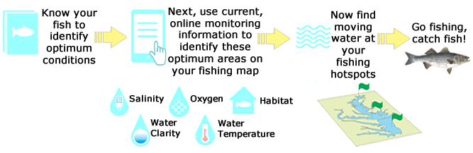
Click on each step below to view information and links. Follow the 'How To' tutorials in each step to learn how to put all this information into practice and find your best fishing locations:
Step 1 - "Think like a fish": Understand water conditions and habitat areas your target fish prefers
 Step 1 - "Think like a fish": Understand water conditions and habitat areas your target fish prefers
There is a wealth of information available in books or on-line about all Chesapeake Bay gamefish that will teach you where, when and how to find and catch them. Once you understand their favorite seasonal haunts, pull out your charts and get ready to start zooming in on productive spots for your next fishing trip.
Follow the 'How To' tutorials in each step to learn how to put this knowledge into practice:
>> How To Think Like a Fish << (opens in popup)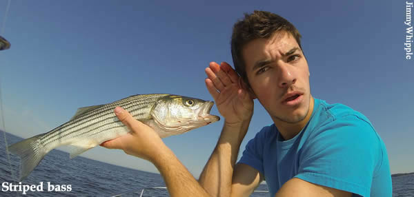
Think like a fish links:
Step 1A - Understand your fish:
- Chesapeake Creature Conditions - Eyes on the Bay (opens in new tab)
- Fish Facts - Maryland Department of Natural Resources (opens in new tab)
- Fish Field Guide - Chesapeake Bay Program (opens in new tab)
Step 1B - Get out your charts:
Step 2 - Eliminate areas outside preferred salinity range
 Step 2 - Eliminate areas outside preferred salinity range
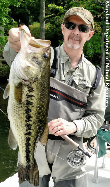
Some Chesapeake Bay fish are better than others at surviving over a range of salinity conditions. For instance, striped bass are found anywhere from freshwater to the ocean. For the fish with limited salinity ranges such as largemouth bass, their habitat will expand or contract with changing bay salinities. However, bay salinities in any spot will vary greatly due to the amount of rainfall entering through the bay's rivers. During years of low rainfall amounts, saltier conditions will move further up the Chesapeake Bay. If you know what salinity your target gamefish prefers and compare it to current salinity maps, you can eliminate unproductive water.
>> How To: Eliminate areas outside preferred salinity range << (opens in popup)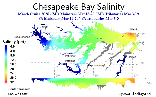
NOTE: Please note that not all VA trib data are available, so there are larger than normal data gaps in the VA tribs. Additionally, CB5.3, CB5.4W, CB5.4, CB5.5, LE3.6, LE3.7, CB6.1, CB6.2 and CB6.3 were not sampled in March.
Data source: Maryland Department of Natural Resources Eyes on the Bay and Virginia Estuarine and Coastal Observing System (VECOS).
Funding for monitoring: US Environmental Protection Agency Chesapeake Bay Program and state sources.
Salinity Preferences for Gamefish:
Choose a species to view its salinity preference.
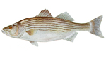
Striped bass: found throughout 0-35 ppt
Salinity Links:
- Current vs. Historical Salinity Comparison - Eyes on the Bay
(real-time / near real-time / recent) (opens in new tab) - Salinity Monitoring Stations - Eyes on the Bay
• Use 'Filter station' dropdown to select continuous monitoring, long-term monitoring
(real-time / near real-time / recent) (opens in new tab) - Salinity Monitoring Buoys - Chesapeake Bay Observing System (CBOS)
(real-time) (opens in new tab)
Dive Deeper:
• For more background read about, salinity parameters and definitions (opens in popup).
Step 3 - Eliminate poorly oxygenated areas
 Step 3 - Eliminate poorly oxygenated areas
Fish need dissolved oxygen to survive. During cooler months, there is plenty of oxygen in most areas of the Chesapeake Bay. However, when the waters warm, there are large areas of the Chesapeake Bay's deeper waters that have very little or no oxygen. This is caused by the dense, salty, deeper waters inability to be recharged with oxygen from surface mixing. In addition, algae blooms also cause low oxygen levels at night through respiration or when they die and decompose. In general, avoid fishing in waters with less than about 3 mg/l of dissolved oxygen.
>> How To: Eliminate poorly oxygenated areas << (opens in popup)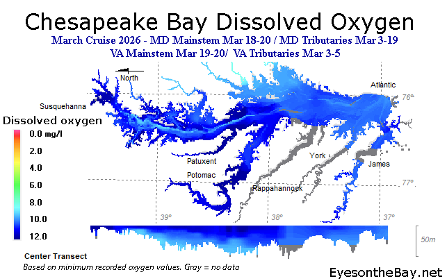
NOTE: Please note that not all VA trib data are available, so there are larger than normal data gaps in the VA tribs. Additionally, CB5.3, CB5.4W, CB5.4, CB5.5, LE3.6, LE3.7, CB6.1, CB6.2 and CB6.3 were not sampled in March.
Data source: Maryland Department of Natural Resources Eyes on the Bay and Virginia Estuarine and Coastal Observing System (VECOS).
Funding for monitoring: US Environmental Protection Agency Chesapeake Bay Program and state sources.
Oxygen Preferences for Gamefish:
Choose a species to view its oxygen tolerance level.
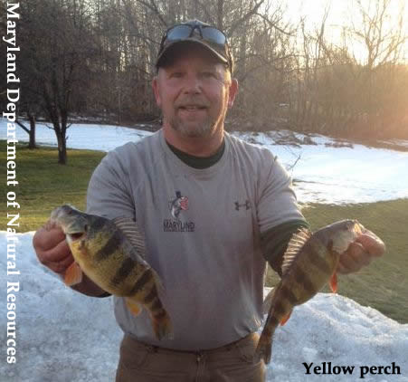
Striped bass: Avoid areas under ~2 mg/L
Dissolved Oxygen Links:
- 'Don't Fish Below This Depth' Map - Eyes on the Bay
• This map identifies the depth at which oxygen levels are unsuitable for most Chesapeake Bay gamefish (~3 mg/L) (opens in new tab) - Oxygen Monitoring Stations - Eyes on the Bay
• Use 'Filter station' dropdown to select continuous monitoring, long-term monitoring
(real-time / near real-time / recent) (opens in new tab) - Depth to Low Oxygen Nowcast & Forecast - Virginia Institute of Marine Science
• This map identifies model-derived current and forecasted depth to low oxygen. (opens in new tab) - Striped Bass Habitat Conditions - Eyes on the Bay
• This dashboard identifies suitable habitat for Chesapeake Bay striped bass based on tolerance thresholds for dissolved oxygen and temperature. (opens in new tab)
Dive Deeper:
• For more background, read about dissolved oxygen parameters and definitions (opens in popup).
• Read about the current status of low dissolved oxygen in our recent Chesapeake Bay Hypoxia Reports (opens in new tab).
Step 4 - Eliminate areas outside of preferred temperature range
 Step 4 - Eliminate areas outside of preferred temperature range
Water temperature greatly influences the seasonal distribution of Chesapeake Bay gamefish. Each type of fish has a preferred temperature range where cooler than normal temperatures will slow them down and warmer temperatures will increase their activity. Some fish will avoid high water temperatures and in summer, often move as deep as possible to areas that still have adequate oxygen levels. To find fish in the cooler months, look for warmer water, and in the warmer months, look for cooler water.
>> How To: Eliminate areas outside of preferred temperature range << (opens in popup)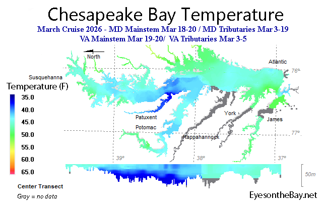
NOTE: Please note that not all VA trib data are available, so there are larger than normal data gaps in the VA tribs. Additionally, CB5.3, CB5.4W, CB5.4, CB5.5, LE3.6, LE3.7, CB6.1, CB6.2 and CB6.3 were not sampled in March.
Data source: Maryland Department of Natural Resources Eyes on the Bay and Virginia Estuarine and Coastal Observing System (VECOS).
Funding for monitoring: US Environmental Protection Agency Chesapeake Bay Program and state sources.
Temperature Preferences for Gamefish:
Choose a species to view its temperature tolerance.
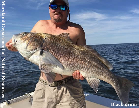
Striped bass: maximum temperature 86°F
Temperature Links:
- Current vs. Historical Temperature - Eyes on the Bay (recent) (opens in new tab)
- Water Temperature by Depth - Eyes on the Bay (near real-time) (opens in new tab)
- Temperature Monitoring Stations - Eyes on the Bay
• Use 'Filter station' dropdown to select continuous monitoring, long-term monitoring (real-time / near real-time / recent) (opens in new tab) - Temperature Monitoring Buoys - Chesapeake Bay Observing Network (CBOS) (real-time) (opens in new tab)
- River and Stream Temperatures - National Weather Service (real-time) (opens in new tab)
- Striped Bass Habitat Conditions - Eyes on the Bay
• This dashboard identifies suitable habitat for Chesapeake Bay striped bass based on tolerance thresholds for dissolved oxygen and temperature. (opens in new tab)
Dive Deeper:
• For more background, read about temperature parameters and definitions (opens in popup).
Step 5 - Eliminate areas with poor clarity
 Step 5 - Eliminate areas with poor clarity
Poor water clarity can make it hard for fish to find and capture food. Water clarity is impacted by amount of suspended sediment and algae in the water. Excess sediment carried into the Chesapeake Bay by large rains or re-suspended by wave action can reduce water clarity and result in coffee-colored water. Fish will avoid high levels of suspended sediment but they will often feed in or near the edges of this coffee-colored water because these areas often contain food. Large algal blooms can often color the water various shades of green or brownish red. In some cases, fish will avoid areas with dense algal blooms because the algae can be toxic, or cause low oxygen levels at night or when the algae die and decompose.
>> How To: Eliminate areas with poor clarity << (opens in popup)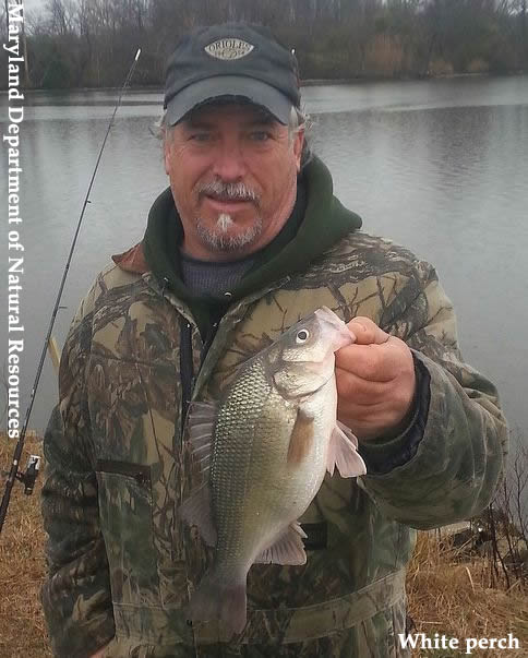
Clarity Links:
Step 5A - General Water Clarity:
- Satellite Overview - Eyes on the Bay (daily updates via NASA) (opens in new tab)
- Current vs. Historical Clarity (secchi depth) - Eyes on the Bay (opens in new tab)
- Water Clarity Monitoring Stations - Eyes on the Bay
• Use 'Filter station' dropdown to select continuous monitoring, long-term monitoring. (real-time / near real-time / recent) (opens in new tab) - Turbidity Monitoring Buoys - Chesapeake Bay Obs. Network (real-time)
• Select a site, then 'Turbidity' (opens in new tab)
Step 5B - Algal Blooms:
- Satellite Data Maps - Eyes on the Bay (daily updates via NOAA)
• Under 'Choose a Data Map' select 'Chlorophyll' and click 'View Selected.' (opens in new tab) - Harmful Algal Blooms Map - Eyes on the Bay (recent) (opens in new tab)
- Chlorophyll Monitoring Buoys - Chesapeake Bay Obs. Network (real-time)
• Select a site, then 'Chlorophyll A' (fish generally avoid areas > 50 ug/L.) (opens in new tab)
Dive Deeper:
• For more background, read about clarity, turbidity, and secchi depth parameters and definitions (opens in popup).
• For more background, read about algal bloom parameters and definitions (opens in popup).
Step 6 - In the remaining area, identify preferred habitat
 Step 6 - In the remaining area, identify preferred habitat
Fish need places to live, eat, and reproduce. Due to constantly changing Chesapeake Bay conditions, preferred fish habitat for any type of fish can vary greatly throughout the year. Experienced anglers know that gamefish will often congregate on or near areas where relatively deep water is near shallow water or habitat edges. Typical areas include points, drop-offs, channel edges, flats, grass beds, and oyster bars. In the remaining areas on your chart, mark areas with these types of features. The best fishing areas often include a combination of several key habitats, such as oyster bars or grass beds near channel edges, etc.
>> How To: Identify preferred habitat << (opens in popup)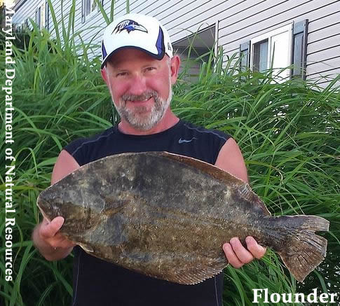
Dive Deeper:
• For more background, read about submerged aquatic vegetation parameters and definitions (opens in popup).
• For more background, read about how to identify the types of submerged aquatic vegetation in your area (opens in popup).
Step 7 - Find moving water
 Step 7 - Find moving water
Once you have identified your fishing spots, find moving water by checking the on-line streamflow, wind, wave conditions and tide charts. Finding moving water is important because it can funnel baitfish and crabs through the prime habitat areas where gamefish feed. Rising tides can move fish into shallower areas while falling tides can pull prey out of the shallower areas into deeper channels where gamefish will feed. Some areas fish better on falling water and others fish better on rising water.
Wind direction, duration and speed can mean a big difference to your fishing day. Not only does wind oxygenate the water, but winds blowing against the tide can often produce larger waves than normal and can slow tidal flushing. Winds blowing in the same direction of the tide can speed up tidal flushing.
Increased flows can improve fishing by cooling and oxygenating the water and dislodging food, but when flows get too high, they can quickly alter conditions by decreasing water clarity and salinity.
>> How To: Find Moving Water << (opens in popup)
Moving Water Links:
- Tide Predictions Map - Eyes on the Bay
• Use 'Filter station' dropdown to select 'Tide predictions' (opens in new tab) - Maryland Tides - Maryland Department of Natural Resources (opens in new tab)
- Wind & Wave Conditions - Chesapeake Bay Observing Network (opens in new tab)
- Marine Forecast - National Weather Service (opens in new tab)
- Streamflow stations - United States Geological Survey (real-time) (opens in new tab)
Step 8 - Go fishing and catch fish!
 Step 8 - Go fishing and catch fish!
Putting it all together
The whole purpose of this process is to help you find the best places to fish.
- First learn about where your fish live and preferred conditions.
- Next, pull out your Chesapeake Bay charts and a marker.
- Now visit your regional websites with current oxygen, salinity, temperature and water clarity conditions.
- As you move through each step, continue to cross off unsuitable areas on your chart.
- Now in the remaining areas on your chart, begin highlighting prime habitat.
- At this point, find moving water by checking your tide charts, wind conditions and flow at these prime areas.
You have now identified the best places to find fish right now, not last week or last month, but right now.
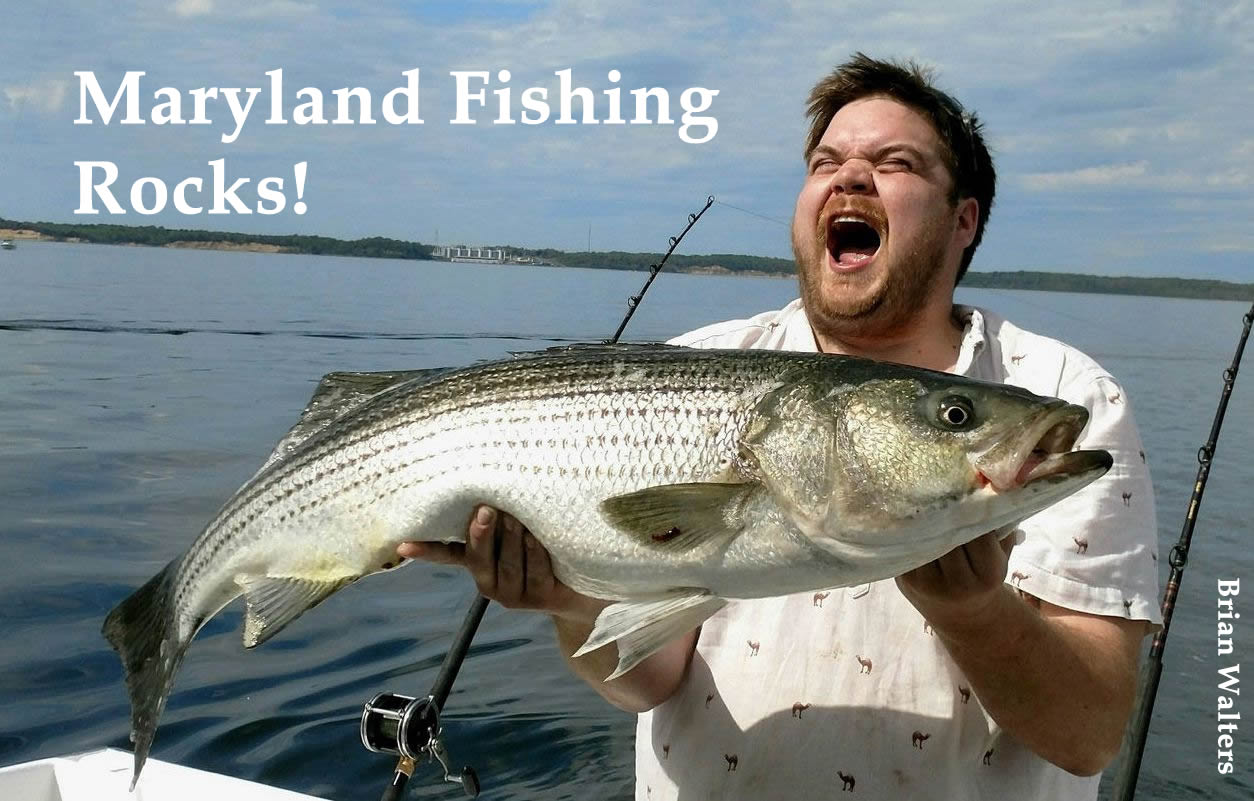
The last step, and most fun, is to go fishing and catch a bunch of fish! And when you do, don't forget to take photos and submit them to the Angler's Log! (opens in new tab)
Other great fishing resources from Maryland Department of Natural Resources:
 Fishing Access
Protecting and restoring your local waterways
 Protecting and restoring your local waterways
As avid anglers, your voice is important to make sure that we all have clean and healthy waterways to explore, enjoy and experience great Chesapeake Bay fishing. When you work together with other anglers, everybody wins - the fish thrive and we all get more chances to make more of those magic moments on the water.
-
Report a Bay Problem in Maryland: (866) MDE-GOTO / (866) 633-4686
(opens in new tab)
- Fish kill or algal bloom
- Public sewer leak or overflow
- Radiation accident or safety violation
- Underground tank leak
- Air pollution violation
- Public water supply problem
- Oil or hazardous material spill
- Sediment, wetland, mining & agriculture pollution problem
- Simple, effective ways you can help the Bay: Chesapeake Bay Program (opens in new tab)
If you have comments or suggestions drop us a line!