
Fixed Station Monthly Monitoring
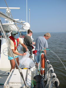 The fixed station monthly monitoring program consists of sites that have been sampled monthly or twice monthly since 1985. Sites are visited by our Research Vessel Kerhin and smaller boats, or accessed via road/ferry crossings. Water quality profiles are taken, as well as nutrient, sediment and chlorophyll samples. Virginia follows identical sampling protocols and full data results are available via the EPA Chesapeake Bay Program Data Hub.
These data are the backbone of the Chesapeake and Coastal Bays management and restoration efforts. They are instrumental in determining the long-term trends and current status of water quality in the region. The data underlie products such as water quality report cards and barometers, as well as models that help to refine watershed management efforts.
Fixed station, monthly monitoring data is currently available for 101 stations. Charts for water temperature, salinity, pH, secchi depth (water clarity), and bottom dissolved oxygen depict the long-term monthly minimum, maximum and average results versus current monthly conditions.
Click here to view a downloadable table of Long Term Fixed Stations, with site coordinates.
Query for charts and a summary table of data below:
|
Location: Southwest of Tilghman Island >> Click here to view a station map << Coordinates (NAD83): Latitude: 38.6448°, Longitude: - 76.4177° View/download table of Fixed Station Information |
Description: This station is a mid-channel site located in the mid Chesapeake Bay, southwest of Tilghman Island. The station is located in the mesohaline zone (salinity 5 to 18 ppt) with an approximate depth of 26 meters. Stations in this section of the Bay monitor water quality of the deep trough near the Choptank River. | |
2026
Surface Water Temperature
|
Surface Water Temperature (° F)
|
|
Surface Water Temperature °C
Chesapeake Bay Mainstem / MD Mid Bay (CB4.2C) |
|||||
|---|---|---|---|---|---|
| Month | Minimum | Mean | Maximum | 2025 | 2026 |
| January | 32.70 | 38.50 | 45.50 | 37.40 | 39.20 |
| February | 31.80 | 37.10 | 42.80 | 36.50 | 33.60 |
| March | 35.80 | 42.10 | 46.90 | 44.60 | 43.20 |
| April | 45.50 | 52.30 | 58.60 | 52.30 | 56.80 |
| May | 58.30 | 62.80 | 70.80 | 65.50 | Not Sampled |
| June | 65.30 | 73.60 | 76.90 | 77.70 | Not Sampled |
| July | 76.50 | 80.10 | 83.30 | 83.30 | Not Sampled |
| August | 76.80 | 80.00 | 82.80 | 78.30 | Not Sampled |
| September | 70.00 | 75.20 | 79.70 | 74.10 | Not Sampled |
| October | 59.70 | 65.50 | 74.30 | 72.00 | Not Sampled |
| November | 48.90 | 54.70 | 61.00 | 53.80 | Not Sampled |
| December | 38.80 | 45.70 | 53.20 | 46.60 | Not Sampled |